Mission to Earth · Earth-Observation
000%  ·  CALIBRATING DESCENT
Mission to Earth // Earth-Observation
The Western Ghats  ·  12.9°N · 75.6°E  ·  Sahyadri
Region79 / 100
BiomeRainforest
Tier
Descent target acquired

The Western Ghats

One wall of rock. Two Indias.

Orbital lock — zeroing on the Sahyadri

01 · Orbital lock

One line of rock.

Sixteen hundred kilometres of it, down India’s west coast.

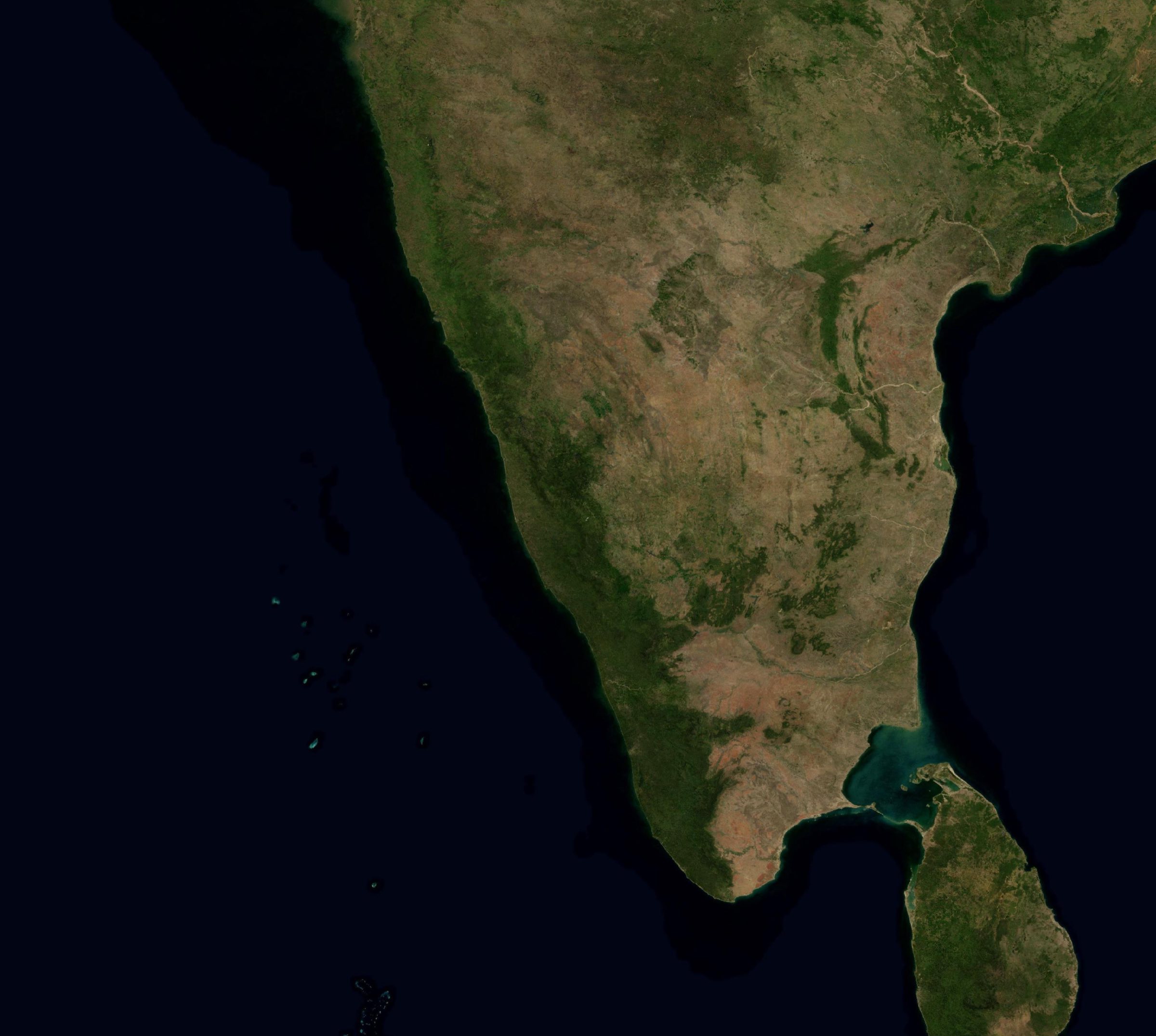
Satellite pass — the green wall seen from orbit

02 · True colour

Green on one side.
Brown on the other.

Same sun. Same latitude. One difference.

Descent scan — a cross-section of the range

03 · Cross-section

The difference is this wall.

Wet sea to the west. Dry plateau to the east.

Drag to look

The windward face — where the monsoon lands

04 · Windward face

Every June, the sea arrives.

The wind hits the scarp, climbs, cools — and lets go. Six thousand millimetres a year.

Soil profile — iron-red laterite

05 · Soil profile

It has been doing this a long time.

Warm rain rinses the silica out and leaves the iron behind. That is the red.

Bedrock — older than the Himalaya

06 · Bedrock

Older than the Himalaya.

Underneath sits the ancient basement of peninsular India — worn down long before the Himalaya existed.

07 · What the wall does

One ridge decides where the rain falls, where the rivers go, and what gets to live here.

A
Location & landform

Not pushed up — left behind.

Not crumpled like the Himalaya. An escarpment — the eroded shoulder of the Deccan Plateau. A sharp wall to the west to catch the wind; a long ramp east for the rain shadow.

1,600 kmRange length
2,695 mAnamudi peak
6States · Gujarat → Tamil Nadu
Plate A · Relief profile
Live
B
The climate cause

One ridge, two Indias.

The southwest monsoon meets the scarp head-on and has nowhere to go but up — orographic rainfall. Cross the crest and the air is wrung dry: the rain shadow starts at once.

6,000 mmWindward rain / yr
SWMonsoon vector
Plate B · Orographic model
Live
C
Water systems

What it catches, it hands inland.

The Godavari, Krishna and Kaveri all rise in or near this range. A narrow strip of coastal forest decides whether the dry interior drinks.

3Major rivers rise here
Godavari · Krishna · KaveriCatchments fed
Plate C · Catchment model
Live
D
The anomaly

And it made a place nothing else could.

Over 7,000 species, a startling share of them found nowhere else — one of the world’s eight hottest biodiversity hotspots. Up high the forest breaks into shola and grassland.

7,000+Species recorded
8Global hotspot group
Plate D · Endemism field
Live
E
Human geography

People live on the ridge too.

Tea, coffee and cardamom on the cool uplands; the Toda and Kadar holding deep knowledge of the forest. And roads, dams and estates cutting it into pieces.

2011 · 2013Ecological-sensitivity reports
Toda · Kadar communitiesIndigenous knowledge
Plate E · Land-use mosaic
Live
08 · Living archive

Six residents of the range. Most of them live nowhere else.

09 · Scan challenge

Two questions. Nothing is saved.

0 / 2 answered

Sources & provenance

Sources & Provenance
  1. 01 UNESCO World Heritage Centre — Western Ghats (inscribed 2012): serial site, outstanding biodiversity value.
  2. 02 Biodiversity hotspots framework (Myers et al., 2000) — Western Ghats & Sri Lanka among global hotspots.
  3. 03 Standard physical-geography treatment of orographic rainfall & rain-shadow (windward vs leeward).
  4. 04 Anamudi elevation 2,695 m — highest peak in India south of the Himalaya.
  5. 05 Peninsular river sources — Godavari, Krishna, Kaveri catchments in/near the Western Ghats.
  6. 06 WGEEP (Gadgil, 2011) and HLWG (Kasturirangan, 2013) ecological-sensitivity reports.
  7. 07Standard regional-geology treatment — Precambrian basement of peninsular India beneath the Deccan escarpment.
  8. 08Satellite plate — NASA Earth Observatory, Blue Marble: Next Generation (MODIS-derived cloud-free true-colour composite), via NASA GIBS. Public domain.
Region79 / 100 · Western Ghats
Biome · TierRainforest · ★
Coordinates12.9°N · 75.6°E
Verify gatePre-verify · pending

Figures are teaching-grade and awaiting the fact-verification gate and human sign-off. Every claim carries a logged source; unverifiable claims are cut before public release.

Curriculum alignment · NGSS MS-ESS2-5 / HS-ESS2-4 · AP Human Geography · AP Environmental Science · IB DP Geography · CBSE Geography (X) · ICSE · Cambridge IGCSE 0460

Mission to Earth — an Edmo experience
Signature · Orbital-to-canopy dive · Sahyadri